



A disaster that was initially believed to have been caused by an earthquake in the Himalayan region has been linked instead to a glacial collapse and debris flow, according to the United States Geological Survey (USGS).
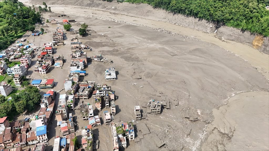
The event occurred near the border between Nepal and China on August 26, triggering a massive flow of water and debris downstream and causing widespread destruction in parts of Nepal and Tibet.
At least 160 people have been killed, while hundreds of others remain missing following the disaster.
The development has raised fresh questions about how unstable glaciers and glacial lakes can contribute to sudden and destructive floods in mountainous regions.
What happened in the Himalayas?
The disaster struck early Wednesday near the Nepal-China border. In the immediate aftermath, seismic activity detected in the region was initially interpreted as an earthquake.
The USGS later revised that assessment after analysing seismic recordings, satellite imagery and other data.
According to the agency, a seismic event with a magnitude of 5.2 was detected near the border at about 8:37am local time on August 26. It was initially reported as a magnitude 4.4 earthquake.
Further analysis, however, indicated that the seismic signals were produced by a glacial collapse and debris flow rather than an earthquake.
The collapse sent huge amounts of ice, water, rocks and other debris downstream, producing catastrophic impacts on communities located along the affected waterways.
Nepal’s Foreign Minister Shishir Khanal had initially suggested that an earthquake could have triggered a landslide, which then blocked a river and caused water to surge downstream.
Other possible explanations included a glacial lake outburst flood or an ice avalanche.
How can a glacier cause a flood?
Glaciers are large masses of ice that move slowly across mountainous terrain. As temperatures rise, glaciers can melt and form lakes, often held back by natural barriers made of ice, rocks and loose debris.
These barriers can sometimes become unstable.
If the barrier collapses, enormous quantities of stored water can suddenly escape. This phenomenon is known as a glacial lake outburst flood, or GLOF.
Such floods can be extremely destructive because they can release large volumes of water within a short period. The water can pick up rocks, mud, trees and other material as it travels downhill, transforming an already powerful flood into a fast-moving debris flow.
A glacier or ice mass can also collapse directly, sending ice and debris into valleys and waterways.
In mountainous areas such as the Himalayas, where communities and infrastructure are often located along rivers and narrow valleys, such events can have devastating consequences.
Why was it initially mistaken for an earthquake?
The confusion arose partly because the collapse generated seismic activity.
When large masses of ice, rock and debris suddenly move, they can produce vibrations that are detected by seismic monitoring stations. These signals can resemble those generated by an earthquake.
The USGS said its initial assessment changed after researchers examined information from nearby seismic stations, long-period seismic waves and satellite imagery.
The combined evidence indicated that there had been no conventional earthquake responsible for the disaster.
Instead, the seismic signal was associated with the movement and collapse of the glacier and debris.
This distinction is important because understanding the actual cause of a disaster can influence how authorities monitor risks and prepare communities for similar events.
What happened to communities downstream?
The collapse had devastating consequences on both sides of the Nepal-Tibet border.
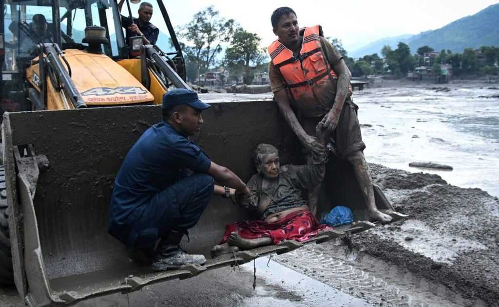
Torrents of water and debris swept downstream, destroying homes and leaving large numbers of people unaccounted for.
Nepal’s disaster agency reported that 823 people remained out of contact on August 27, more than 24 hours after the disaster.
The death toll was also expected to change as rescue teams continued searching affected areas and authorities worked to establish the full scale of the destruction.
The incident highlights the dangers faced by communities living downstream from glaciers and glacial lakes, particularly as changing environmental conditions increase concerns about the stability of high-altitude ice and water systems.
The disaster also demonstrates why satellite monitoring, seismic networks and early-warning systems are increasingly important in Himalayan countries.
For residents living in vulnerable valleys, receiving warnings even minutes before a sudden flood or debris flow can make the difference between escaping to safety and being caught in the path of destruction.


